

Out with the tide. Home to the shore.
Pine forests behind you. Open water ahead. A landscape shaped by generations of work and life.
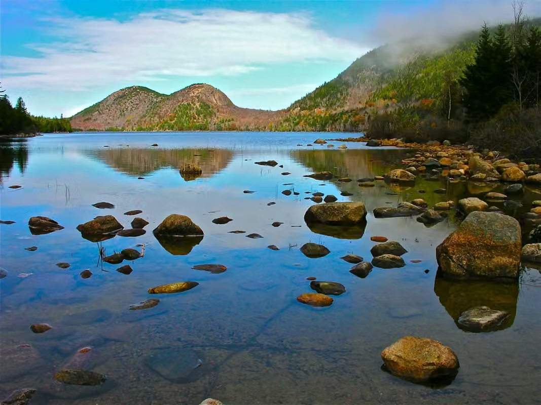
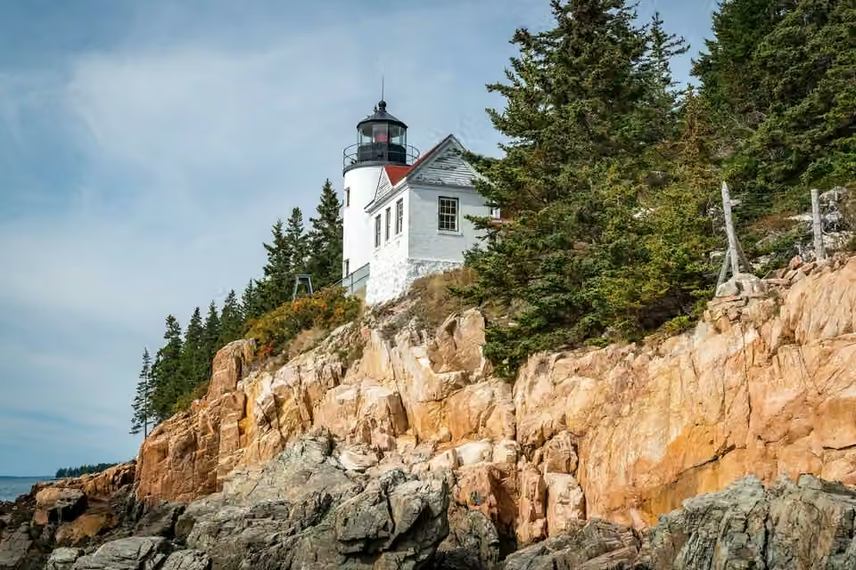
At low tide, another world appears among the rocks.
Maine's coastline is not a straight line. Bays, islands, and headlands interlace, rocky shores dividing the land into small coastal patches facing the sea. At Acadia's edge, waves crash against granite, and forests often stretch to the shore.
The water recedes, leaving behind pools in the crevices and depressions. Life experiences submersion and exposure, changes in salinity and temperature; a seemingly tranquil patch of water, however, is actually at the edge of land and sea. Neither pools, rocky cliffs, nor near-shore waters can be understood through the same environmental lens.
Scenic views and navigable areas can change with sea surface heights, and truly understanding the sea requires considering tides and weather. It also needs to make room for the life on the rocks.
A lobster’s journey from wharf to table.
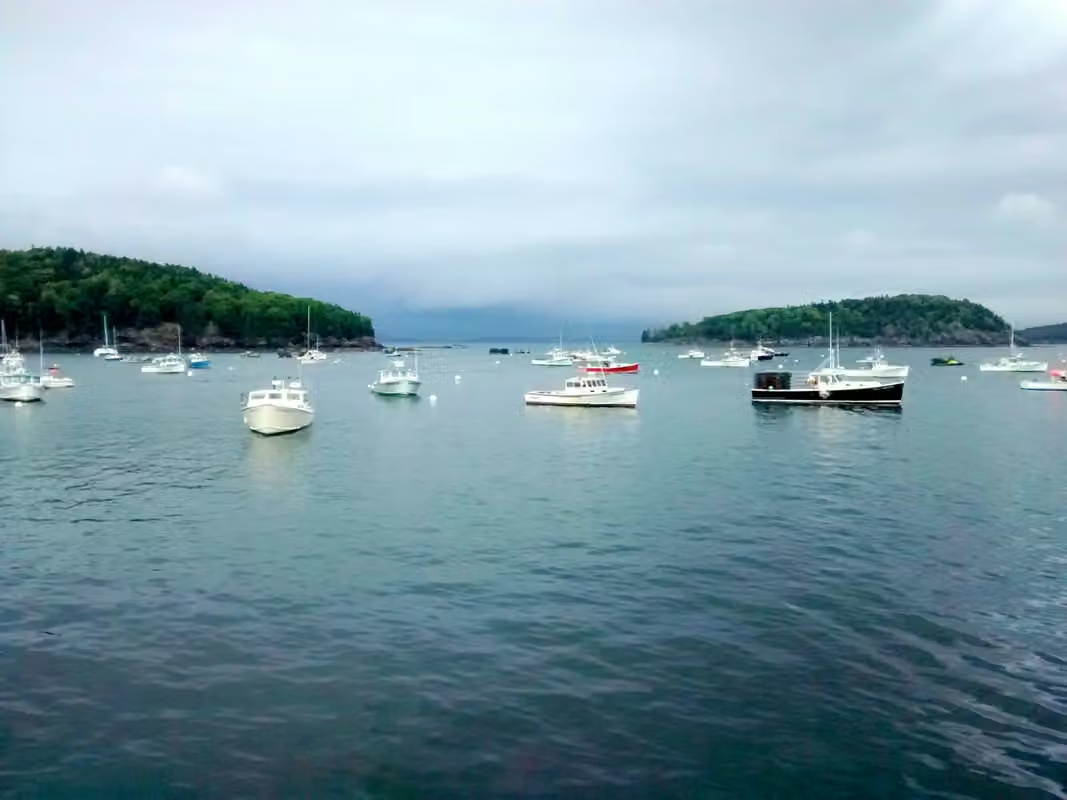
Seafood is a prominent image of Maine, but fishing is a series of daily labor: going out to sea, pulling nets, sorting, then entering the acquisition, rearing, processing, or transportation stages. Ships in the harbor and facilities on land are interconnected to subsequent sales.
Knowing the fishing data starts with knowing where the transactions take place. The price paid to the fishermen when the catch is landed differs from what consumers pay in restaurants and retailers; it also includes transportation, storage, processing, and services.
Maine lobster landings in 2025. Preliminary state Department of Marine Resources figures.
About $461 million
In March 2026, records from 2025 show that the landed value of lobsters was approximately $461 million. This represents the value at the capture end and should not be considered the total sales of the lobster industry or the profit after subtracting costs for the fishermen.
$5.85 per pound
Annual average prices combine transactions made at different times, with different specifications and terms. Buyers, restaurants and cold-chain businesses still need purchasing plans that reflect availability, product form and delivery conditions.
Working space on the shore matters, too
Docking, unloading, refrigeration, maintenance, and transport all require actual facilities. The shoreline used by beachfront visitors for leisure differs from that used by fishing operations that need working space, though both share the same stretch of shore.
Maine Department of Marine Resources: Preliminary 2025 commercial fisheries landings statistics, released in March 2026.
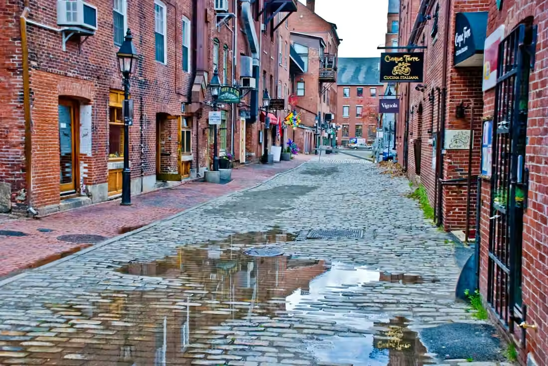
An old port best explored on foot.
Brick walls, shops, and streets leading to the water give Portland its unmistakable port-city character. The Old Port welcomes visitors while remaining connected to dining, professional services, and residents' daily lives.
City commerce isn't confined to one side facing the sea. Services like healthcare, offices, everyday shopping, and residential communities form a continuous work and consumption area. Different customer flows, operating hours, and rental spaces are required for the streets bustling with tourists and those serving the local residents.
For a restaurant, shop or small service business, understanding the street can be more useful than knowing the statewide population. Why customers come, how long they stay and whether they need parking or delivery all shape how a location works.
A city and a small harbor serve different markets.
Portland is able to connect a wider customer and service network; smaller coastal communities, however, have tighter connections with the seasons, the harbor, and the daily lives of local residents. The differences between locations are an important part of Maine's business environment.
Forest stories, carried downriver.
Behind today's coastal image lies an inland history shaped by forests, logging, and river transport.
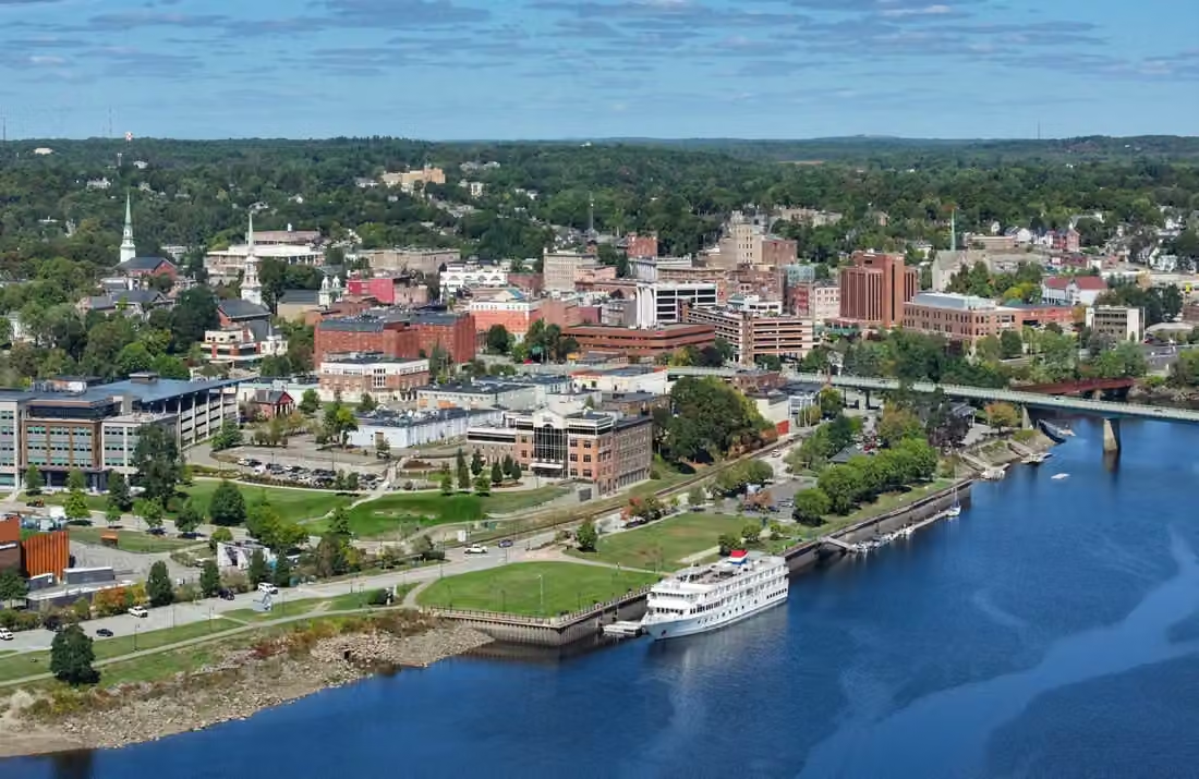
Bangor: a city shaped by lumber
Logging and river transport once connected Bangor to a wider hinterland. Logs flowed downriver into the processing and trade networks, with logging camps, river facilities, sawmills, and ports forming the historical backbone of the local economy.
Timber transport in the Allagash watershed depended on river flows and access to the sea. Engineering works changed the routes timber could take, showing how infrastructure actively shaped which cities received forest resources.
Bangor’s industrial history is only part of its present-day role. Healthcare, retail and other services support the surrounding region, with a reach that extends beyond the city boundary.
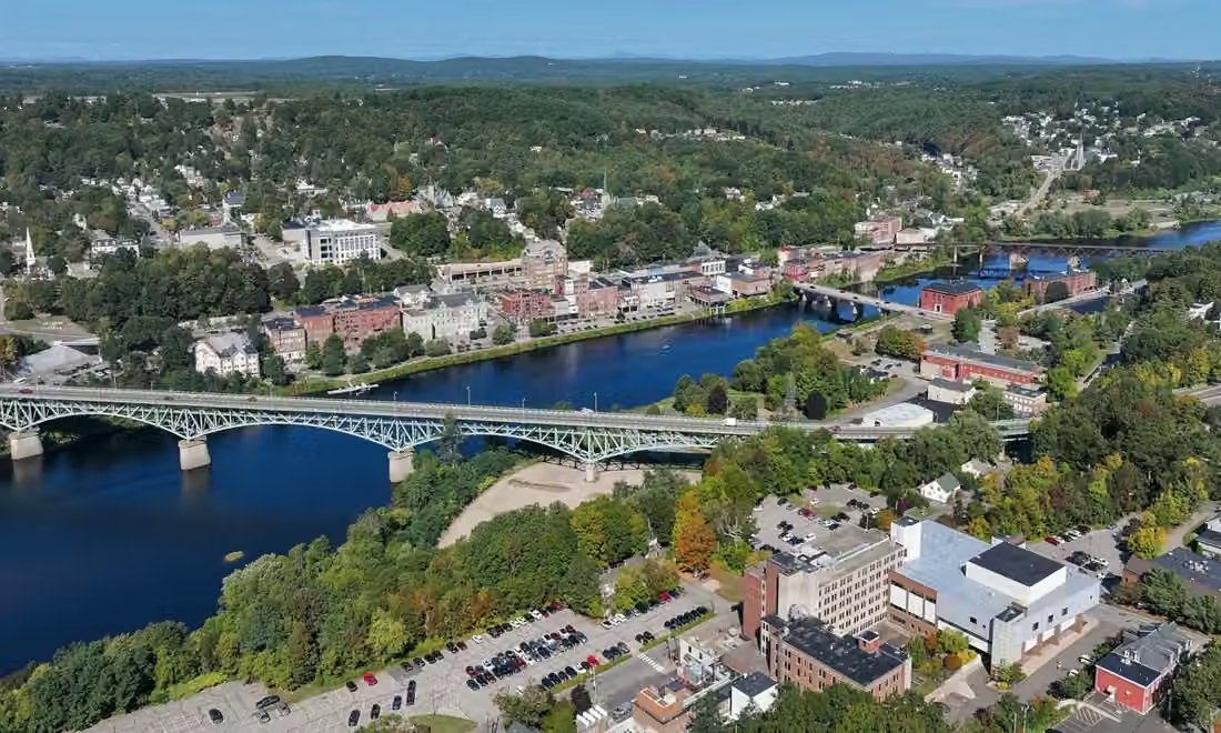
Augusta: river and state capital
The Kennebec River once provided conditions for wood transportation, manufacturing, and trade. The development of factories also accompanied immigrant labor and community formation, and the riverbank retains a historical interweaving of urban production and life.
In the 19th century, Augusta became the state capital, where public institutions and river industries shaped the city. After the great fire of 1865, streets along the Water Street were gradually rebuilt; today's street scene reflects this recovery and continuation.
Government, community services, and historic districts make this place different from coastal vacation towns. To truly know Maine, one must explore inland cities along rivers, not just along the coast.

A state flower that grows on a pine branch.
In 1895, Maine officially adopted the white pine cone and needle cluster as its state flower symbol. It is not a botanical flower: white pine is a gymnosperm that reproduces through cones.
In a state-wide vote to choose a representative plant for the 1893 World's Fair in Chicago, white pine emerged victorious over other candidates. This choice was both tied to the economic utility of the trees and reflective of their place in the local culture and forests.
The history of forestry is not just about timber numbers. Rivers, roads, seasonal labor by workers, and communities that rely on forests are all part of it. White pine branches gather these connections into a rustic yet distinctive place symbol.
Stone bridges and woodland roads follow the hills.
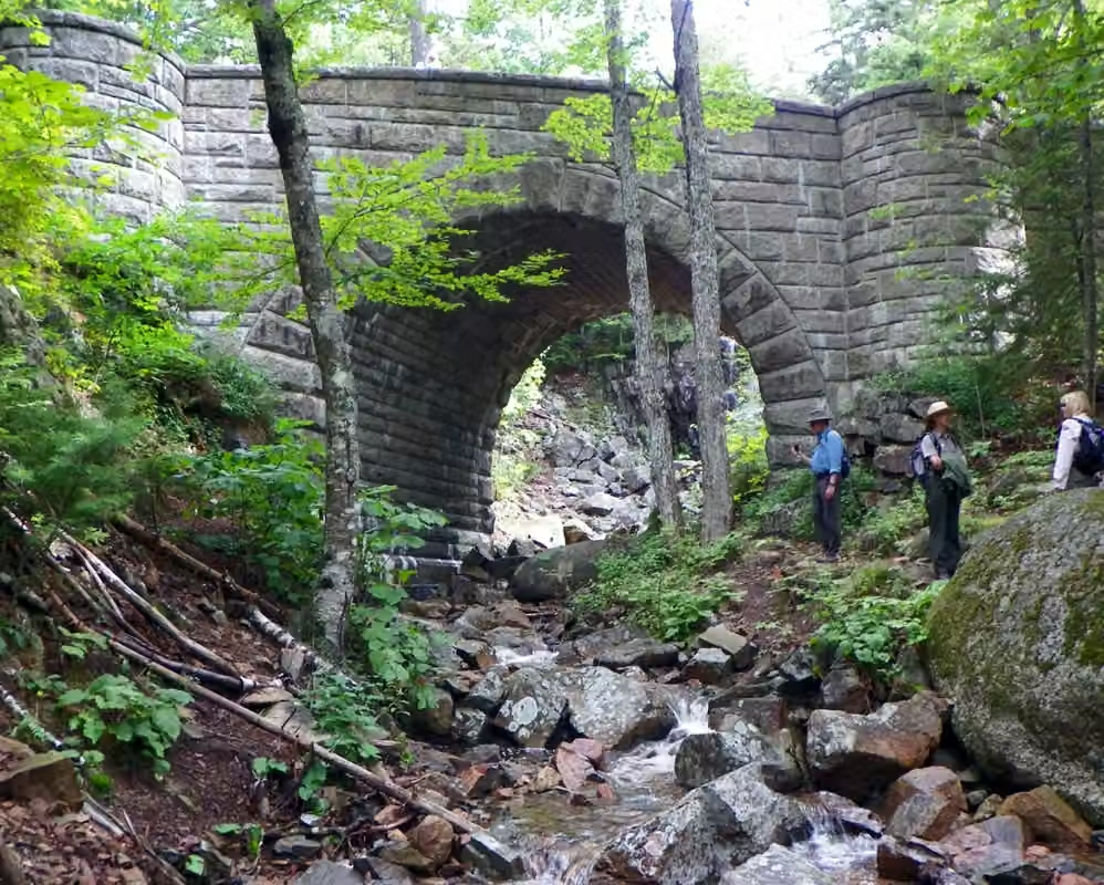
A road shaped by the landscape
John D. Rockefeller Jr. and his family supported the carriage roads built between 1913 and 1940. About 45 miles within the park wind around valleys and slopes, following the terrain, preserving trees and alternating close views with distant vistas.
The details are in the stonework
Guardrails, paved bridges, and entry buildings give this road a unified and detailed appearance. Today, walkers, cyclists, and carriages share these roads that are off-limits to cars, and the historic mode of touring continues in new forms.
An older homeland, still present today.
For centuries before national parks existed, the Wabanaki people had lived along the coast, on islands, and inland. Resources from the sea, fresh water, forests, and wetlands provided different kinds of resources, and connections with these environments spanned the year, not just a season.
Today, the Wabanaki community still maintains a cultural and lived connection here. To understand Acadia, one should not place the original inhabitants only in the distant past; the coastal names, techniques, and ongoing community life are all parts of the place's history.
Start with the needs of the community.
Seafood, forests, and tourism define the state image, but hospitals, stores, buildings, and professional services also support daily life. Business for tourists needs to consider peak and off-peak seasons, while services for residents depend on community size, distance, and long-term usage frequency.
Industries & establishments · 2023
The work that keeps communities running.
Maine's employment structure includes many long-term services oriented towards its residents. Coastal tourism and fishing are noteworthy, but cannot replace the observation of demand in healthcare, retail, manufacturing, and surrounding community needs.
The state recorded 43,345 employer establishments and 548,469 paid employees. A single company may operate several stores, offices, or factories, so establishments are not a count of registered companies.
U.S. Census Bureau, 2023 County Business Patterns. The series primarily covers private, nonfarm establishments with paid employees. Employment is measured for the pay period that includes March 12. The 2023 release was the latest in this series available when checked; it is not a measure of current monthly employment.
An editorial feature by STATE.REPORT. Image creators and licenses are credited below.
Sources & further reading
U.S. Census Bureau: state population estimates for July 1, 2025.
National Park Service: Coastal, Intertidal, and Nearshore Habitats.
National Park Service: Coastal Communities, Navigation, and Fisheries History.
National Park Service: Indigenous Continuity with the Acadia Region.
National Park Service: Road construction, stone bridge preservation, and landscape protection.
Maine's agriculture, conservation, and forestry department oversees forests, rivers, and timber transport.
Augusta Comprehensive Plan: Kennebec River, Industrial, and State Development.
Maine State Office of the Secretary of State: Symbolized by the state flower established in 1895.
Image credits & licenses
Acadia National Park 02.JPG · Plh1234us · CC BY-SA 3.0。
TheOldPort.jpg · PhilipC · CC BY 2.0。
Bangor, Maine.jpg · Quintin Soloviev · CC BY 4.0。
Augusta, Maine downtown.jpg · Quintin Soloviev · CC BY 4.0。
Bass Harbor Head Light Station 2016.jpg · FirozAnsari · CC BY-SA 4.0。
Lobster Boats, Bar Harbor, ME - panoramio.jpg · Aaron Zhu · CC BY-SA 3.0。
Acadia Carriage Path Bridge.JPG · Kevin A. Trostle · CC BY-SA 3.0。