

Utah · Landforms and local life
Utah
The white of an ancient lake. The depths carved by a river.
From western salt flats to cities along the mountains, then south into sandstone canyons. Wherever water has passed, it has left a different landscape and way of life.
An empty-looking plain holds a lake’s history.
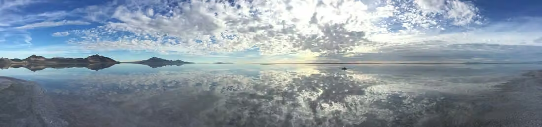
Today's salt flats once lay beneath ancient Lake Bonneville. As the lake shrank after the ice age, salts became more concentrated. Shallow groundwater brings salt to the surface; evaporation leaves a white crust behind.
Salt pans are also changing. Winter water can dissolve the surface, and evaporation in warmer seasons causes the salt to crystallize again. The calm reflection in the photo is a particular weather and surface condition at a specific moment, not a fixed mirror reflecting the four seasons.
Salt flats have also entered the history of car racing, film, and photography. The vast, flat surface is impressive, but this landscape has its own hydrological processes and should not be seen as a static white floor.
Beneath the surface, far-reaching connections.
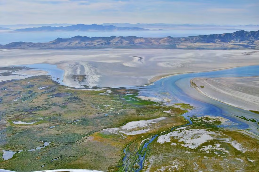
Illustration of water cycle relationships, not a diagram of water proportion.
Why does the salt remain?
Great Salt Lake has no surface outlet to the ocean. Rivers carry dissolved minerals into it; as water evaporates, salts remain. The lake is a remnant of ancient Lake Bonneville, but its salinity, water level and shoreline continue to change with environmental conditions.
High salinity does not mean an absence of life. Brine shrimp, brine flies, and surrounding wetlands sustain many migrating and resident birds. Small lake organisms also connect this inland water with aquaculture farther afield.
When water levels decrease, salinity and exposed lakebed area change, affecting the ecosystem and surrounding life. Lake protection requires an understanding of inflow volumes, agricultural and urban water usage, wetlands, and habitats, not just looking at a pretty aerial photo.
Mountains at the city’s back.
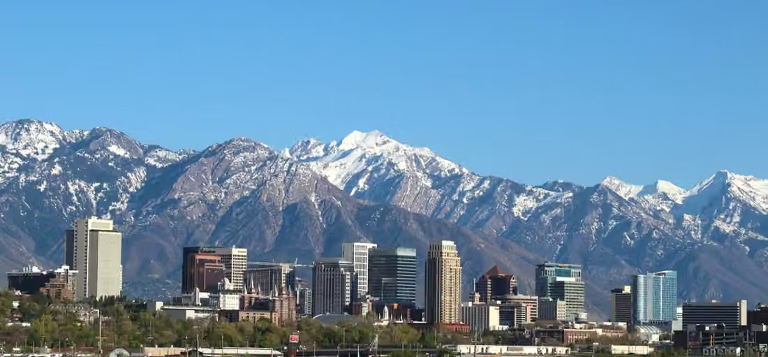
Street directions reveal the city’s beginnings.
Salt Lake City's street grid grew from surveys begun in 1847 and the building of an early religious community. Its blocks, roads, and public buildings still provide a framework for understanding downtown.
The city has continued to evolve beyond its original plan. Public spaces such as Liberty Park provide places for recreation, exercise, and everyday encounters, while universities, healthcare, and research bring new jobs and residents.
The University of Utah's Research Park has developed since the late 1960s as a place for university–business collaboration. Research, testing, professional services, and training reveal more about its work than a broad label such as technology hub.
Utah Department of Workforce Services. Released September 18, 2026.
Jobs are growing, but pace matters.
Estimated statewide nonfarm employment
Increase from August 2025
In August 2026, Utah's non-farm jobs grew by approximately 1.2% year-over-year; the estimated unemployment rate, adjusted for seasonality, stood at 3.5%. Job numbers and unemployment rates come from different statistical systems, and the former does not equate to registered business numbers.
The state workforce department also noted slower hiring conditions for some people seeking part-time work, additional hours, or their first job. Statewide employment growth does not mean every industry or job seeker experiences the same changes.
Different business needs along the Wasatch Front.
Research and technology businesses rely on specialized talent and partner organizations; the growth in population and associated medical, construction, and everyday services depend more on specific communities and service areas. Placing job changes back into industries and cities helps to see their relationship to actual operations.
A university city with an industrial past.
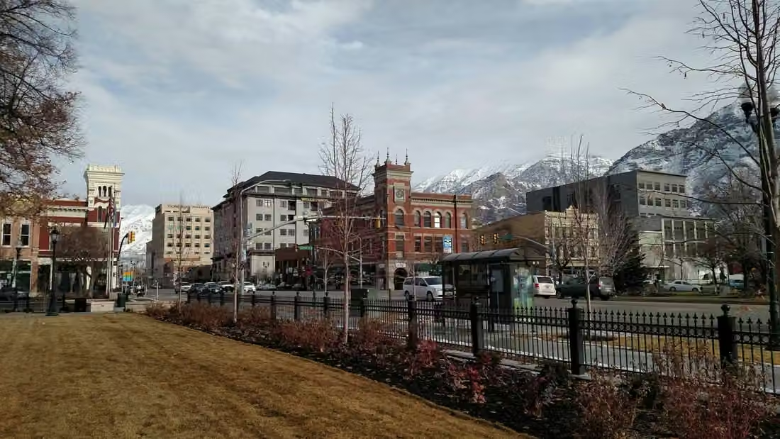
Brigham Young University's predecessor was founded in 1875. The institution has long helped shape Provo, with teaching, cultural events, housing, and commerce keeping campus and neighboring streets closely connected.
Provo is not just a campus. A wool textile factory in the area was once an important business during the late 19th and early 20th centuries, leaving a history of local industry and labor. When discussing tech and knowledge industries today, it is equally worth preserving these earlier forms of production and living.
Mountain cities have traffic and people moving between them, but each city's institutions, neighborhoods, and history are distinct. Salt Lake City, Provo, and Ogden cannot be dismissed as just three locations in a single urban corridor.
Ogden
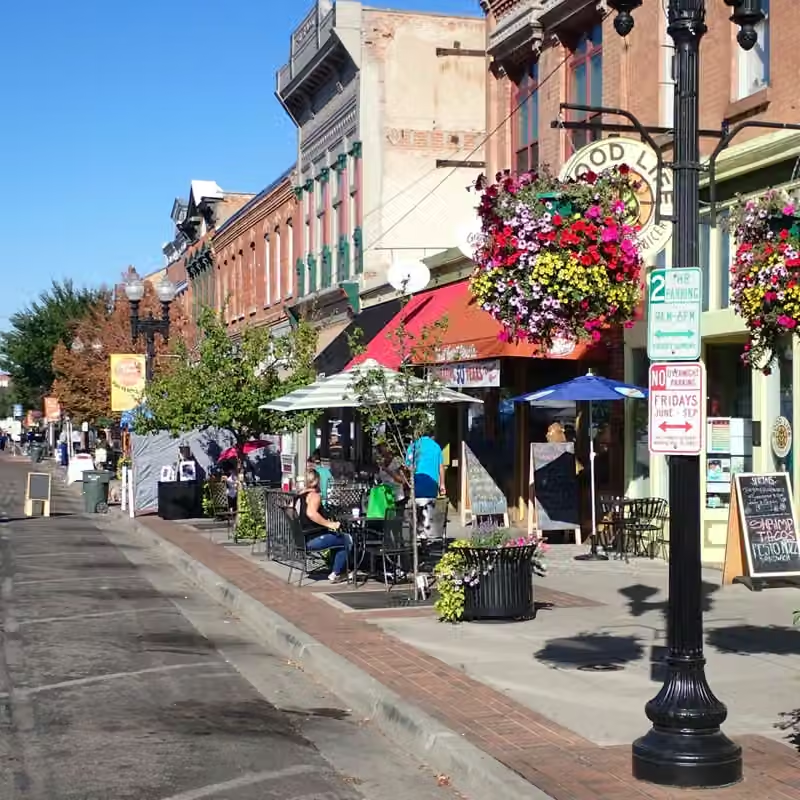
A station opens onto a busy street.
Ogden was an important railroad junction. Trains from different directions brought travelers, workers, merchants, and new ideas. Union Station and Historic 25th Street preserve central parts of that urban history.
Railways not only changed where goods were delivered but also how hotels, restaurants, and stores were clustered. Today, museums and historic districts continue to tell these stories, reminding us that city culture comes from migration, encounters, and everyday commerce.
Water forms lakes—and slowly opens the rock.
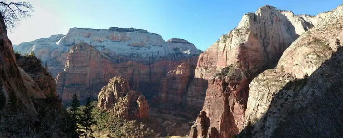
A river winds deep into the rock layers.
The Virgin River and its tributaries cut into sandstone, creating Zion's deep canyons and steep walls. Both uplift of the plateau and the interaction of rock strata and stream erosion were involved in this process; seemingly solid canyons are still changing.
From low-lying rivers to rocky cliffs high above, the distance is short but the environment is quite different. The landscape is not a single backdrop of red but a space intersected by water, rock layers, vegetation, and altitude.
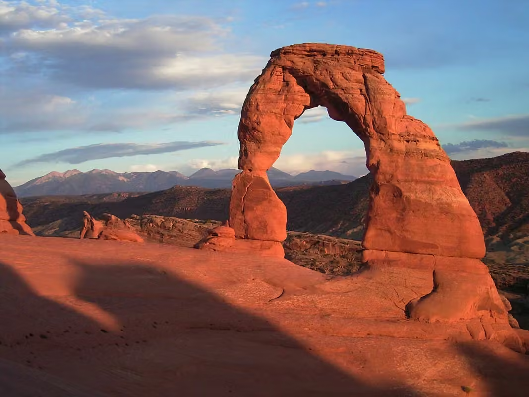
An arch formed by many forces.
The movement of the underground salt layers causes the overlying rock layers to deform and crack, and rainfall, freeze-thaw cycles, and erosion continue to expand these fissures, gradually leaving thin walls and arches. Although water in arid environments is not plentiful, it still continues to shape the landscape.
The arch is not a single, finished sculpture. It changes its shape due to weathering, rock fragmentation, and gravity over time. The current form is a moment within this prolonged process.
Behind the red rock, think of ice.
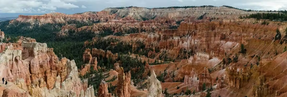
The pillars of Bryce Canyon are formed through repeated freezing and thawing. Water enters the cracks, freezes, and expands, widening the rock over time; water then carries away the loose debris. The cliffs, windows, and isolated pillars exhibit different stages of weathering.
These formations differ from Zion's deep canyon and Delicate Arch. Seen together, they reveal southern Utah's shared geological setting and the distinct processes that shaped each place.
The land’s story begins long before the photograph.
Utah's Division of Indian Affairs describes eight Tribal Nations in the state. Ute, Paiute, Shoshone, Goshute, Navajo, and other cultures maintain distinct communities and relationships with land; they cannot be reduced to a single western tradition.
Religious settlement, railroad construction, mining, and later urban growth added further layers to Utah's history. Its story also includes the contemporary lives of Indigenous peoples, the memories of diverse communities, and the changes still unfolding in its cities.
White returns, this time in bloom.
From salt flats to a tiny flower.

Sego lily was officially designated as the state flower of Utah in 1911. Its three light-colored petals and dark, striped center make for an easily recognizable shape.
It belongs to both the local flora world and the state's historical and symbolic realm. Beyond salt, water, and rock, tiny flowers allow one to look down and see a lighter side of the expansive landscape.
Recent changes within the wider economy.
Industries & establishments · 2023
The work that keeps communities running.
Monthly employment reports describe recent changes, while annual establishment figures show the distribution of industries. Healthcare, retail, professional services, and construction meet daily needs in the cities along the mountain front and in communities across the state.
The state recorded 95,494 employer establishments and 1,579,974 paid employees. A single company may operate several stores, offices, or factories, so establishments are not a count of registered companies.
U.S. Census Bureau, 2023 County Business Patterns. The series primarily covers private, nonfarm establishments with paid employees. Employment is measured for the pay period that includes March 12. The 2023 release was the latest in this series available when checked; it is not a measure of current monthly employment.
An editorial feature by STATE.REPORT. Image creators and licenses are credited below.
Sources & further reading
U.S. Census Bureau: state population estimates for July 1, 2025.
Utah Geological Survey: Bonneville Salt Flats, shallow groundwater, and salt deposits.
Utah Geological Survey: Ice Age Lakes, Evaporation, and Endorheic Basins.
Utah Office of the Great Salt Lake Commissioner: Brine shrimp, waterbirds, salinity, and water use across the watershed.
Library of Congress: Survey and Mapping of Urban Blocks in 1847.
Salt Lake City government: Parks, public spaces, and modern living.
Provo City Library: Local industry in the late nineteenth and early twentieth centuries.
Brigham Young University: The institution's development and its relationship with Provo.
City of Ogden: population, commerce, and urban culture shaped by the railroad.
National Park Service: The erosion of the sandstone canyon by the Virgin River.
National Park Service: Salt layers, fissures, and erosional forces.
National Park Service: Freeze-thaw action, weathering, and hoodoo formation.
Utah Tribal Affairs Department: Eight tribal nations and contemporary communities.
Utah State History: State Flower, Local Memory, and the Formal Designation in 1911.
Image credits & licenses
2015-09-29 08 58 11 Panorama north, east and south from the end of the road to Bonneville Salt Flats International Speedway near Wendover, Utah, with calm waters covering the salt flats and reflecting the sky and mountains.jpg · Famartin · CC BY-SA 4.0。
SLC Skyline 2024.jpg · Invictus323 · CC BY 4.0。
Downtown Provo.jpg · Creator: Javin Weaver · CC BY-SA 3.0。
US Utah Ogden 25th Street.JPG · Thomas Wozniak · CC BY-SA 4.0。
Delicate arch sunset.jpg · Palacemusic · CC BY-SA 3.0。
Farmington Bay, Antelope Island and the Great Salt Lake.jpg · pedrik · CC BY 2.0。
Bryce Amphitheater from Sunrise Point Highres 2013.jpg · Tuxyso · CC BY-SA 3.0。
Zion Canyon from Observation Point trail.jpg · Kognos · CC BY-SA 4.0。